
Rotary Scanning Mid-Far Infrared Hyperspectral Imager
Description
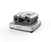
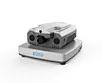
The ATH3080 is a hyperspectral imager designed by Optosky for the mid-to-far infrared band. Compact and lightweight, it utilizes a Stirling cooler for deep CCD cooling, ensuring low dark current, low noise, high spatial and spectral resolution, and a wide imaging range. Comprising an imaging lens and a hyperspectral spectrometer based on transmission grating technology, it has excellent aberration characteristics.
The high-performance infrared CCD with Stirling cooling provides clear imaging and minimal noise. The ATH3080 measures real-time spectral information of plants, water bodies, and soil, producing spectral images that reveal physicochemical properties, aiding in plant classification and growth studies. The system's compact design and high spectral resolution allow it to form independent measurement systems with a field rotary or indoor linear scanning platform. It can also be mounted on UAVs for aerial remote sensing operations.
Model | Features |
ATH3080-MW | 2.5~5.0μm,Stirling cooling |
ATH3080-LW | 7.8~12.3μm,Stirling cooling |
ATH3080-LW-NT | 7.8~12.3μm,non-cooled thermal radiometer |
Features
- Wavelength Range: 2.5~5.0μm, 7.8~12.3μm.
- Ultra-Low Temperature Stirling Cooled CCD or Uncooled Detector.
- Detector Resolution: 640x512 or 320x256.
- Advanced Image Compression Algorithm.
- Compact Size: 386 mm x 300 mm x 162 mm.
- Lightweight:<7.500g.
- 13 Megapixel Visible Light Camera, Integrated Spectroscopy.
- No Mechanical Scanning, High Reliability.
Application
- Geological and Mineral Resources Exploration.
- Precision Agriculture and Crop Growth & Yield Assessment.
- Forest Pest and Fire Monitoring.
- Coastline and Marine Environment Monitoring.
- Pasture Productivity and Rangeland Monitoring.
- Lake and Watershed Environmental Monitoring.
- Remote Sensing Education and Research.
- Meteorological Research.
- Ecological Environment Protection and Mine Environmental Monitoring.
- Water Quality Testing and Soil Monitoring.
- Agricultural and Livestock Product Quality Testing.
- Military, Defense, and Homeland Security.
- Disaster Prevention and Mitigation.