
SWIR Hyperspectral Imager
ATH1010-17
Hyperspectral imaging systems are a powerful tool for non-contact or remote sensing of molecular chemical information of material quality or composition.
Delivery
FOB
minimum order
1 unit
Country of Origin
Made in China
Quantity
Description
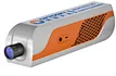
ATH1010-17 is compact and light SWIR hyperspectral camera fit to be mounted to the drone. With features of high spatial and spectral resolution, wide field imaging.
ATH1010-17 is made of two parts, imaging camera and hyperspetral imager applied PGP transmission grating technology and excellent aberration.
ATH1010-17 SWIR hyperspectral camera uses high resolution & performance cooled InGaAs CCD with 640×512 pixels or 1280×1024 pixels, clear imaging and low noise. ATH1010-17 SWIR hyperspectral camera shape long tube fit to multi-rotor drone. But ATH1010-17L shape bending optical bench design can fit more to fixed wing drone or short landing gear drone.
ATH1010-17 SWIR hyperspectral camera can fit to in field measure spectral information of plants, water, soils, the obtained spectrum used for analysis. The physical and chemical properties of plants build modeling with spectral database to be applied to plants classification, plants growth etc.
With compact design, high resolution, push broom imaging, this SWIR hyperspectral camera can be extended to many application in field, including rotary and indoor scan system, mounted on the drone for remote sensing.
Model | Wavelength Range |
ATH1010R-17 | 0.9~1.7 μm, 640*512 |
ATH1010R-17H | 0.9~1.7 μm, 1280*1024 |
ATH1010R-25 | 1.0~2.5 μm, 640*512 |
Features
- Imaging mode:Transmission grating , high sensitivity
- Max.spectral range: 0.9~1.7 μm or 1.0~2.5 μm
- Max.spatial channels: 640 or 1280
- Max.spectral channels: 512 or 1024
- FOV: 15.2°(Lens changeable)
- Outstanding imaging performance
- Data format compatible with ENVI
- Compact size: 370mm x 85mm x 95mm
- Lightweight: 1780g
Application
• Geology and mine exploration
• Agricultural growth and output appraisal
• Forestery and plant disease monitor
• Fire prevention monitor
• Coastline and sea environment monitor
• Pasture grass production and growth monitor
• Lake and river monitor
• Remote sensing teaching & research
• Meteorological research
• Ecosystem protection and mine monitor
• Water quality, soils monitor
• Agriculture and animal products quality
• Military, defense and land security
• Disaster prevention