
Born for Large-Area Remote Sensing! Optosky Releases the ATH9600 Multi-Lens UAV-Borne Multispectral Imaging System
Need four or five flights to monitor a thousand mu of farmland?
Cannot operate on cloudy days or at dusk, with so much noise that images are unclear?
Traditional equipment is cumbersome, and assembly and debugging consume a great deal of manpower?
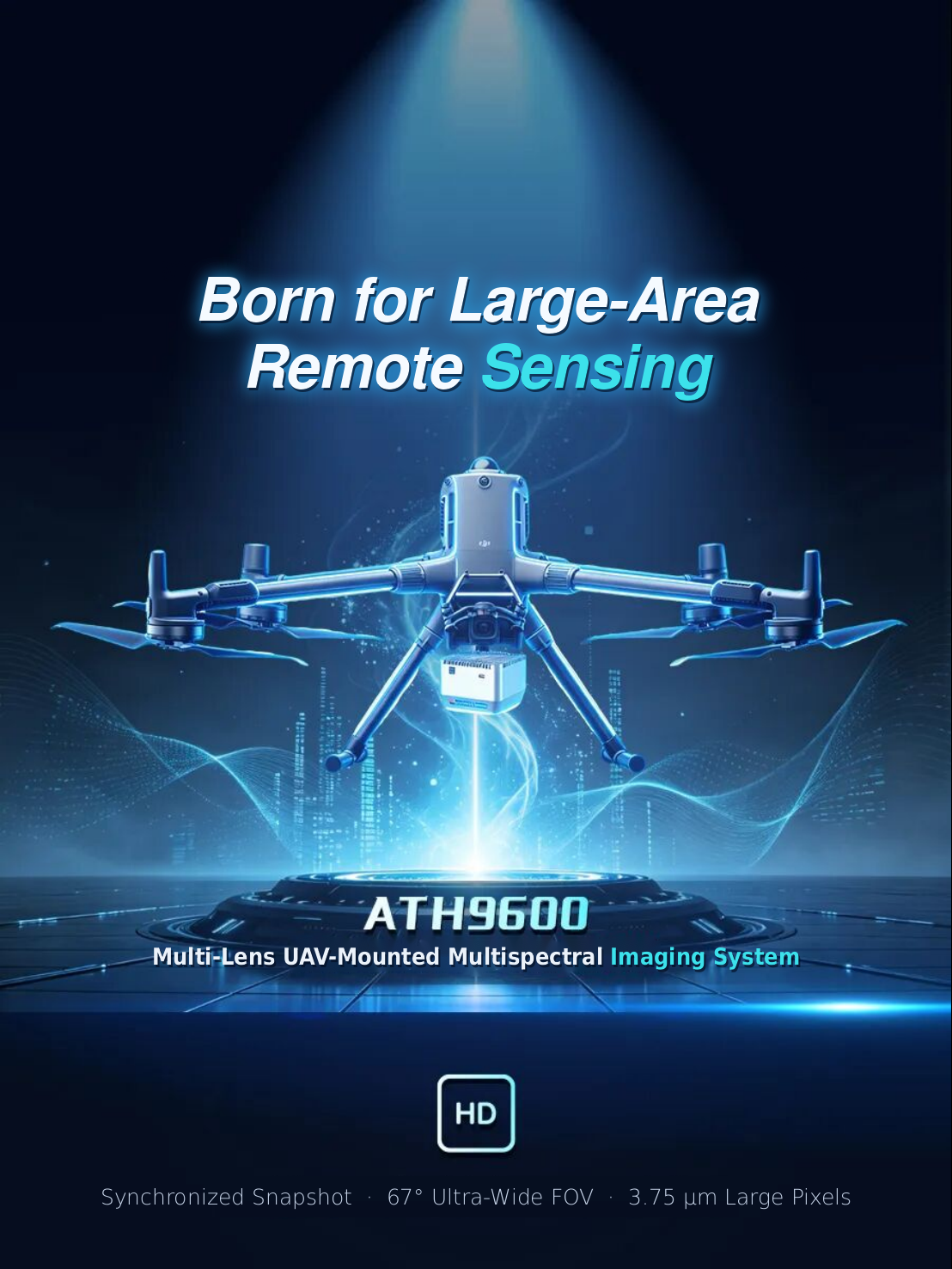
Addressing challenges in large-area remote sensing operations such as efficiency, environmental adaptability, and system integration, Optosky has newly released the ATH9600 multi-lens UAV-borne multispectral imaging system. With synchronous snapshot, ultra-wide field of view, large-pixel imaging, and native interface integration, it brings a more efficient multispectral data acquisition solution to low-altitude remote sensing.
01 Core Selling Points at a Glance: Born for Large-Area Remote Sensing!
1. 67° Ultra-Wide Field of View, Coverage Area Increased by 3–5 Times
A dramatically different view: featuring an ultra-wide field of view of 67° (H) × 53° (V), far exceeding the 47°/50° field of view of conventional cameras.
Cost reduction and efficiency improvement: the coverage area per photo increases multiple times, reducing the number of flight routes required. Monitoring thousand-mu-level farmland can be easily completed in a single takeoff and landing.
2. Synchronous Snapshot Architecture, No Hovering Required During Flight
High-speed cruise operation: built-in 6 independent multispectral channels + 1 RGB channel (RGB effective pixels up to 13 Mpx), all channels expose synchronously at the same moment.
FPGA hardware-level synchronization: adopts global shutter and pixel-level hardware synchronous triggering, completely eliminating image misalignment and jelly effect caused by flight displacement, improving overall operational efficiency by more than 3 times.
3. 3.75 μm Ultra-Large Pixel, All-Weather High-Quality Imaging
Breaking through low-light limitations: photon collection area is 3.5 times that of 2.0 μm competitors, with excellent low-light performance and signal-to-noise ratio.
Extended operating window: whether cloudy or at dawn/dusk, image quality remains clear, adding 2–3 hours of effective operating time per day.
4. DJI X-Port Native Integration, Ready for Takeoff in 5 Minutes
Plug and play: natively compatible with DJI Sky-Port/X-Port interfaces, no need for cumbersome third-party adapter modules.
Rapid deployment: only 5 minutes from mounting to takeoff; the quick-release design makes every operation worry-free and effortless.
5. Unique Band Advantage: 720 nm Red-Edge Narrowband
Equipped with a unique 720 nm red-edge narrowband, compared with traditional broadbands, it can more precisely capture early vegetation stress signals, providing more reliable scientific data for crop growth monitoring, pest and disease early warning, and yield estimation.
02 In-Depth Focus: Four Practical Scenarios and Application Cases
The ATH9600 demonstrates outstanding technical implementation capabilities in water body monitoring, orchard management, crop disease early warning, and classification surveys.
Scenario 1: Water Ecological Monitoring—Chlorophyll-a Concentration Inversion in Poyang Lake, Jiangxi
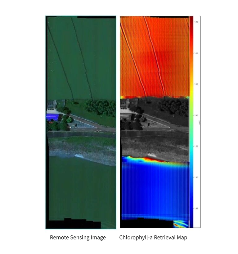
User pain points: the water area at the inflow of Poyang Lake is vast, manual sampling cycles are long, and timeliness lags. In addition, the lake water has high sediment content (a typical turbid Class II water body), and conventional multispectral equipment suffers from low inversion accuracy due to insufficient spectral resolution.
Solution:ATH9600 was used for low-altitude remote sensing flights to obtain high-spectral/high-spatial-resolution water body imagery. Combined with ground sampling data, a chlorophyll-a inversion model suitable for turbid water bodies was established.
Practical results: successfully inverted the chlorophyll-a concentration distribution of turbid Class II water bodies, reduced the operation cycle by more than 70% compared with traditional manual monitoring, and achieved an information leap from "discrete points" to "continuous area."
Scenario 2: Precision Orchard Management—Growth and Stress Diagnosis in an Apple Planting Base in Xinjiang
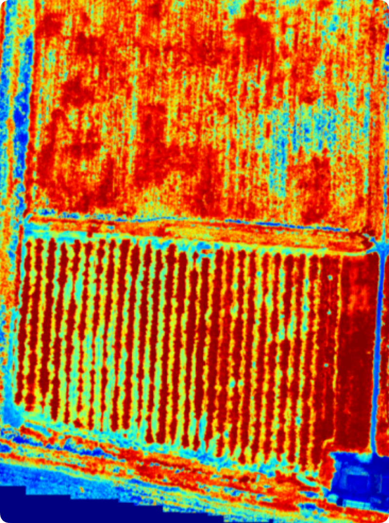
Apple Growth Assessment Map
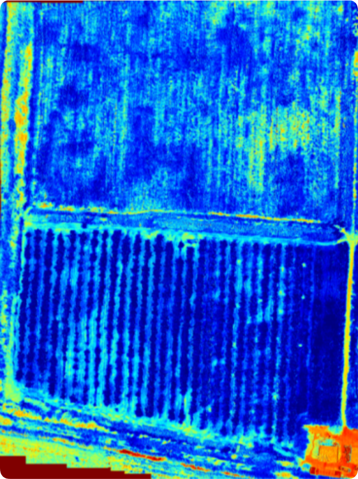
Apple Stress Assessment Map
User pain points: orchards are large, and manual inspection is time-consuming and labor-intensive. Early water and nutrient stress (such as nitrogen deficiency) is difficult to detect with the naked eye; by the time it is discovered, yield reduction has often already occurred. Fruit growers tend to apply fertilizer blindly and indiscriminately, resulting in high costs and damaged quality.
Solution: ATH9600 is used to extract spectral reflectance of fruit trees. Based on built-in NDVI (Normalized Difference Vegetation Index) and NDWI (Normalized Difference Water Index) models, it quantitatively evaluates tree growth and leaf water content.
Practical results: before lesions/withering symptoms appear to the naked eye, water and nutrient stress areas are identified in advance, seizing the golden period for intervention. It generates a spatial distribution map of orchard growth to guide differentiated fertilization by zone and targeted irrigation, effectively reducing fertilizer costs.
Scenario 3: Early Warning of Pests and Diseases—Growth and Stress Monitoring of Mulberry Fields in Guangxi
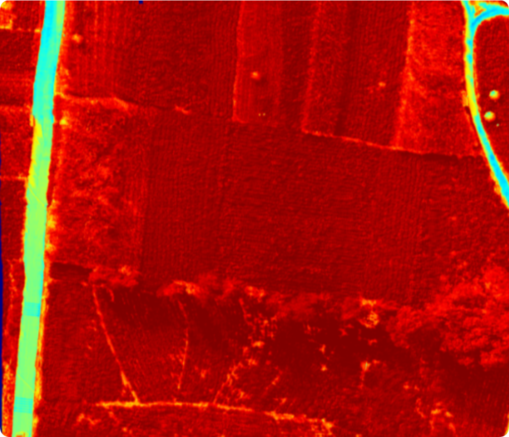
Mulberry Leaf Growth Assessment Map
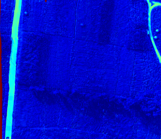
Mulberry Leaf Water Content Stress Assessment
User pain points: pests and diseases spread quickly in mulberry fields. Traditional visual inspection has limited coverage and delayed detection. There is a lack of quantitative assessment tools, and extensive pesticide spraying causes waste and non-point source pollution.
Solution: ATH9600 is mounted for full-coverage inspection. Combined with built-in crop models, it outputs graded maps of mulberry field growth and water stress.
Practice result: a single flight completes large-area mulberry field inspection and quickly identifies plots with abnormal growth. Based on visual stress grading maps, targeted precision spraying can be carried out, greatly reducing pesticide use and lowering environmental pollution.
Scenario 4: Complex Crop Classification—Resource Survey of a Traditional Chinese Medicinal Herb Planting Base in Anhui
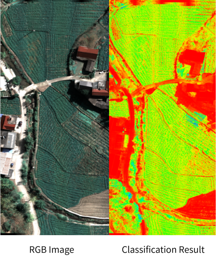
User pain points: medicinal herbs and conventional crops are intercropped, with extremely similar appearance and morphology, making them difficult to distinguish in traditional RGB imagery. In addition, plots are fragmented with irregular boundaries, and satellite remote sensing resolution is insufficient, resulting in an unclear planting baseline.
Solution: ATH9600's multispectral bands are used to build a reference spectral library of ground features, and spectral angle mapping and machine learning algorithms (such as random forest) are used for pixel-by-pixel classification.
Practical results: breaks the bottleneck of identifying crops with similar appearances and accurately outlines fragmented plot boundaries. It outputs high-precision thematic maps of crop spatial distribution, providing reliable data support for regional agricultural structural adjustment and industrial planning.
03 Key Technical Parameters at a Glance
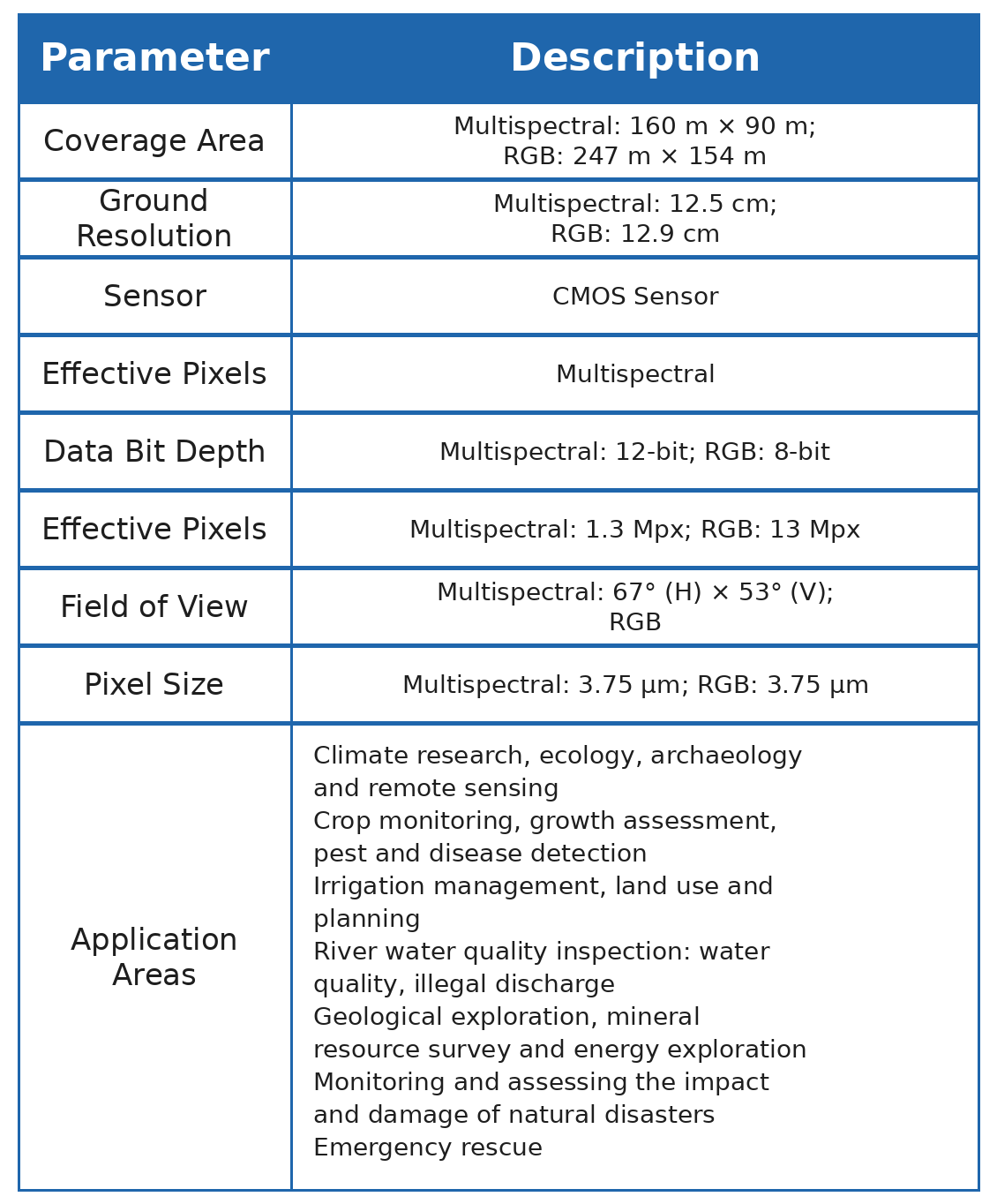
The Optosky ATH9600 multi-lens UAV-borne multispectral imaging system is now officially released! Welcome to contact us to schedule a demonstration flight and product experience.
For more information, please contact:
Email: [email protected]
Web: www.optosky.net
Precision fertilization by UAV for rice at tillering stage in cold region based on hyperspectral remote sensing prescription map
Applications | Hyperspectral ATH9010 for Precise Mulberry Leaf Disease and Pest Identification in Smart Sericulture
Related Article