UAV-Hyperspectral Synergy: Redefining Precision in Ecological, Mineral, and Agricultural Surveys
A national-level scientific research institute in natural resource remote sensing recently visited Optosky for technical exchange and product inspection.
Recently, an expert team from a national-level research institute in the field of natural resource remote sensing visited Optosky to conduct in-depth discussions and technical inspections focusing on hyperspectral remote sensing technology development, advanced spectrometer applications, and intelligent monitoring solutions for natural resources.
This exchange focused on the application demands of hyperspectral imaging technology in natural resource surveys, ecological environment monitoring, geological and mineral analysis, agricultural remote sensing, and other fields. Both parties discussed directions including high-performance spectral detectors, UAV-based hyperspectral remote sensing systems, ground-object spectrum measurement equipment, and hyperspectral data processing platforms.
01 In-Depth Understanding of Hyperspectral Product Portfolio
Exploring New Pathways for Intelligent Remote Sensing Applications
During the exchange, the expert team focused on inspecting Optosky’s hyperspectral product series, learning in detail about technical solutions for different spectral ranges and various application scenarios.
Addressing the needs of natural resource remote sensing applications, Optosky demonstrated hyperspectral imaging devices covering visible, near-infrared, and short-wave infrared bands, capable of acquiring fine spectral information from 400 nm to 2500 nm, providing high-dimensional data support for ground-object identification, resource surveys, and ecological monitoring.
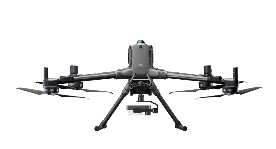
Among them, the UAV-based hyperspectral remote sensing system, with its advantages of lightweight integration, high spatial resolution, and large-area rapid acquisition, can be deployed on drone platforms for regional-scale remote sensing surveys, enabling a complete technical workflow from data collection, spectral analysis, to intelligent modeling.
Meanwhile, the team also introduced the hyperspectral data processing software platform, which supports radiometric correction, spectral analysis, feature band extraction, classification and recognition, and remote sensing model construction, helping users achieve the transition from "data acquisition" to "information mining.".
02 Hyperspectral Technology Empowering Natural Resource Management
Promoting the Intelligent Development of Remote Sensing Technology
As the demand for refined natural resource management continues to grow, traditional remote sensing technologies face new challenges in complex object identification and quantitative analysis. Hyperspectral remote sensing, by acquiring continuous spectral information, can capture subtle spectral differences among various materials, providing more precise technical means for resource surveys and ecological monitoring.
In the natural resource sector, hyperspectral technology can be applied to:
- Mineral resource surveys: mineral identification and composition analysis based on mineral spectral signatures;
- Ecological environment monitoring: ecological status assessment using vegetation and water spectral data;
- Land resource surveys: assisting land cover classification and resource change monitoring;
- Agricultural remote sensing applications: precise analysis of crop growth, nutritional status, and pest/disease detection.
In the future, hyperspectral remote sensing will be deeply integrated with artificial intelligence, big data, and UAV platforms, further enhancing the automation and intelligence of natural resource surveys.
03 Joint Innovation for High-Quality Development of Remote Sensing Technology
This technical exchange not only deepened both parties’ understanding of the development trends in hyperspectral remote sensing technology but also laid a solid foundation for future cooperation in intelligent natural resource perception, remote sensing data applications, and industry-specific solutions.
Optosky will continue to focus on innovation in spectral detection and intelligent remote sensing technologies, promote the application of hyperspectral imaging in more industry scenarios, and contribute to the digital management of natural resources and intelligent remote sensing development.
For more information, please contact:
Email: [email protected]
Web: www.optosky.net
Selecting the Right Remote Sensing Tool for Mineral Exploration: A Deep Dive into Optosky’s Hyperspectral ATH9010
Keep Your Device Working at Peak Performance | Daily Maintenance Guide for ATP9110 Users
Related Article