
UAV-Based Multispectral Soil Moisture Monitoring
author: Callum
2025-01-03
1. Introduction
Soil moisture content, as an important indicator for monitoring and assessing crop soil conditions, plays a critical role in real-time and accurate monitoring. This not only helps improve irrigation management and water resource utilization efficiency in agriculture but also drives the further development of water-saving irrigation practices. Additionally, it offers more possibilities for studying issues related to surface energy distribution in latent and sensible heat, as well as water cycles.
Currently, traditional satellite remote sensing has achieved large-scale, rapid monitoring of soil moisture to some extent. These methods mainly rely on sensors mounted on satellites, aircraft, or other platforms, which detect electromagnetic signals reflected or emitted from the Earth's surface. Based on this data, soil moisture content is estimated, but this approach faces challenges such as low dynamic effectiveness, high costs, and low accuracy.
UAV-based remote sensing technology, combining high flexibility, low cost, and ease of operation, overcomes the limitations of traditional satellite remote sensing. By mounting remote sensing equipment on UAVs, high spatial and temporal resolution data can be rapidly collected. This data is then processed, modeled, and analyzed, providing crucial technological support for the development of smart agricultural management. Remote sensing bands commonly used in soil moisture retrieval include visible light, near-infrared, thermal infrared, and microwave. Notable achievements include using UAV-based thermal infrared imaging for crop canopy temperature monitoring. Although this method has shown some success, challenges remain, such as time resolution issues, the use of L-band radiometers for soil moisture monitoring, and the need to establish regression models for soil moisture content at different depths using spectral index differences.
UAVs have already achieved significant results in agricultural monitoring and information extraction. However, in the field of soil moisture monitoring, the methods and models for UAV-based remote sensing of soil moisture are still being improved. The key challenge and focus of future research lie in how to utilize UAV-based multispectral data for low-cost, convenient, rapid, and accurate soil moisture monitoring in agricultural fields. To explore this issue, the study aims to build a soil moisture inversion model based on UAV multispectral remote sensing by selecting spectral data sensitive to soil moisture, correlating them with actual soil moisture measurements, and validating the model using field-based soil moisture data.
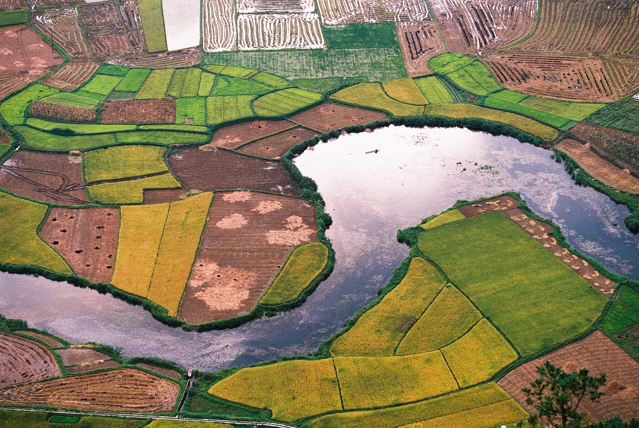
Figure 1 Photo of Moist Soil
2. Data Acquisition and Processing
Remote Sensing Image Acquisition and Preprocessing
Currently, UAV-based remote sensing has achieved significant advancements in agricultural monitoring and information extraction. In the field of soil moisture monitoring, although methods and related models for UAV-based remote sensing of soil moisture are continuously improving, the key challenge and focus of future research lie in how to utilize UAV multispectral data for low-cost, convenient, rapid, and accurate soil moisture monitoring in agricultural fields. To further investigate this issue, spectral data sensitive to soil moisture was selected based on correlation screening, and regression was performed with field soil moisture data to develop a soil moisture inversion model based on UAV multispectral remote sensing. The model was then validated using real soil moisture data.
The data for this study was collected using the DJI Phantom 4 Multispectral UAV. This UAV is equipped with six 1/2.9-inch CMOS sensors (1 inch = 2.54 cm), including one color sensor for visible light imaging and five monochrome sensors for multispectral imaging.
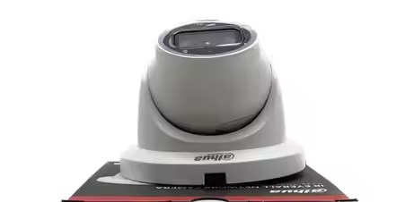
Figure 2 CMOS Sensor
Band Correlation Analysis
In the formula:  represents the correlation coefficient;
  denotes the matrix elements;
  is the mean of the series; and m represents the sample
To establish the gray correlation analysis, feature sequences and parameter sequences (evaluation indicators) are defined. The parameter sequence is normalized by dividing all data by its initial value. After normalization, the correlation between individual spectral bands and soil moisture is computed.
Soil Moisture Acquisition
In the test area, soil moisture samples were taken using a soil moisture recorder at a depth of 5 cm (probe length) in bare soil and sparsely vegetated areas. The data recorded by the instrument represents the volumetric percentage of soil moisture (W%), which indicates the proportion of water volume in a unit volume of soil. All soil moisture measurements are expressed in this manner.
At the same time, GPS was used to record the coordinates of the sampling points. The distribution of soil moisture sampling points in the study area is shown in Figure 2. A total of 34 sampling points were chosen, evenly distributed with a 30-meter interval, taking into account the terrain characteristics of the region.
Soil moisture content is a crucial indicator for monitoring crop soil conditions and plays a key role in real-time and accurate monitoring. It not only improves irrigation management and water resource utilization efficiency in agriculture but also promotes the further development of water-saving irrigation techniques. Additionally, it provides more opportunities to study issues related to surface energy distribution, latent and sensible heat, and water cycles.
Currently, traditional satellite remote sensing monitoring has achieved some degree of large-scale, rapid monitoring of soil moisture conditions. These methods primarily rely on sensors mounted on satellites or aircraft to receive electromagnetic signals reflected or emitted from the Earth's surface, which are then used to estimate soil moisture content. However, these approaches face challenges such as poor dynamic effectiveness, high costs, and low accuracy.
UAV-based remote sensing technology combines high flexibility, low cost, and ease of operation, overcoming the limitations of traditional satellite remote sensing. By mounting remote sensing equipment on UAVs, high spatial and temporal resolution data can be rapidly collected. This data can then be processed, modeled, and analyzed, providing crucial technological support for the development of smart agriculture. Remote sensing bands commonly used in soil moisture retrieval include visible light, near-infrared, thermal infrared, and microwave. Key achievements include using UAV-based thermal infrared imaging for crop canopy temperature monitoring. Although some progress has been made, challenges remain, including time resolution issues and the use of L-band radiometers to monitor soil moisture, the need to select sensitive spectral indices, and the establishment of regression models based on spectral reflectance differences for soil moisture at different depths.
Currently, UAVs have achieved significant results in agricultural monitoring and information extraction. However, despite continuous improvements in the methods and models for UAV-based remote sensing of soil moisture, the key challenge in future research is how to utilize UAV multispectral data for low-cost, convenient, rapid, and accurate soil moisture monitoring in agricultural fields. To investigate this, the study aims to develop a soil moisture inversion model based on UAV multispectral remote sensing by correlating sensitive spectral data with actual soil moisture measurements and validating the model with soil moisture field data.
Figure 3 UAV Sample Point Distribution
3. Model Construction
To improve the experimental efficiency and generalization ability, this study manually set correlation thresholds and constructed both NIR-RE-G three-band and B-R-G-RE-NIR five-band models, ensuring the reliability and accuracy of the models. These models aim to verify their effectiveness and feasibility in soil moisture monitoring, providing methods and a basis for the rapid monitoring of soil moisture in agricultural fields. As spectral models involve multiple band reflectance values, with many independent variables, traditional least squares regression struggles to handle multicollinearity. In contrast, Partial Least Squares Regression (PLSR) can effectively overcome this issue, making it suitable for situations where the number of sample points is fewer than the independent variables. PLSR retains all independent variables, making the regression coefficients easier to interpret. This model is computationally simple, highly accurate, and facilitates qualitative analysis. Therefore, PLSR was used to construct regression models for band reflectance values. Based on three sets of UAV-collected data, 80% of the sample points were selected as the modeling dataset, and SPSS PRO analysis tools were used to calculate the models, resulting in the NIR-RE-G and B-R-G-RE-NIR models.
NIR-RE-G Model:
Y=12.706+0.011×B−51.892×G−47.441×R+49.644×RedEdge−7.302×NIR
B-R-G-RE-NIR Model:
Y=13.088−112.756×G+16.725×RedEdge+22.744×NIR
4. Results and Analysis
By using the established NIR-RE-G and B-R-G-RE-NIR models, spectral data from the overall bands were fused using ENVII software. The resulting images, after formula calculation, were transformed into raster data files generated by the models. Subsequently, ArcGIS was used to refine the raster data. Based on the normal distribution of the raster gray values, the natural breaks method divided the data into six intervals. Evaluation standards were then established by rounding the intervals, resulting in the soil moisture inversion results for the test area.
The spatial distribution of soil moisture in the region exhibited significant variations. Soil moisture content for the same crop showed a similar trend over time. In each experimental phase, the difference in soil moisture content between the two inversion models was only 0.01%, and the overall trend showed an initial increase followed by a decrease.
The soil moisture inversion results allow for a rapid assessment of the overall soil moisture levels in the agricultural field and provide valuable insights into the spatial distribution of soil moisture. This aids in the implementation of precise irrigation and crop management strategies. The rapid and efficient method provides the capability to monitor soil moisture over large areas.
By integrating UAV multispectral data, surface soil data, and vegetation information, inversion models were established to accurately determine soil moisture conditions. These models provide precise decision-making support for agricultural production, thereby improving land resource utilization efficiency.
Figure 4 Model Recognition Results
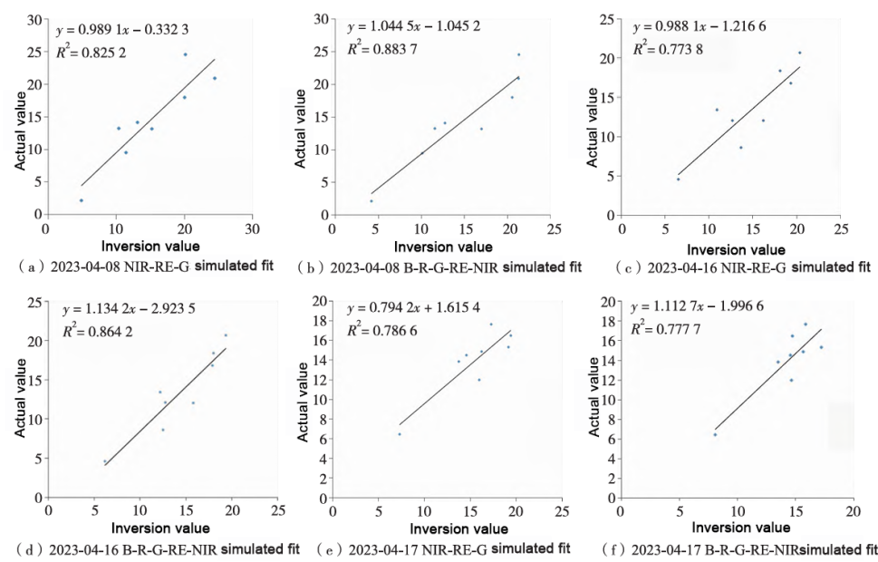
Figure 5 Model Inversion Values vs. Actual Soil Moisture Values Fit
Development and Prospects of Hyperspectral LiDAR for Earth Observation
Leveraging Hyperspectral Remote Sensing for Enhanced Forest Fire Monitoring
Related Article

Discover Optosky’s air–ground collaborative hyperspectral solution for mine ecological restoration monitoring. Combining UAV hyperspectral imaging, fixed-point rotating-scan systems, and field spectroradiometers, it supports vegetation, soil, mineral alteration, and water environment monitoring for green mine evaluation and restoration acceptance.
Applications | Hyperspectral Mine Restoration Monitoring
Compare single InGaAs and CMOS+InGaAs detector architectures in hyperspectral imaging. Learn why both can cover 400–1700 nm, how visible-light-extended InGaAs works, and the trade-offs in calibration, spectral registration, and system integration for applications in agriculture, food safety, and industrial inspection.
Technology | Single InGaAs vs. CMOS+InGaAs in Hyperspectral Imaging
Discover how hyperspectral imaging combined with multi-feature fusion (PCA + 2DCOS + CARS) enables non-destructive three-level grading of chili pepper sunburn with 97.2% accuracy. Learn about the ATH3000 system and Optosky's customized solutions for horticultural crop quality inspection and damage classification.
Can Sunburned Chili Peppers Be Non-Destructively Graded? Hyperspectral Imaging ATH3000 Offers a New Answer
Discover the Optosky ATH9600 multi-lens UAV-borne multispectral imaging system—featuring 67° ultra-wide FOV, synchronous snapshot, 3.75 μm large pixel, and native DJI X-Port integration. Ideal for large-area farmland monitoring, orchard management, pest early warning, water quality inversion, and complex crop classification. Born for efficient, all-weather low-altitude remote sensing.
Born for Large-Area Remote Sensing! Optosky Releases the ATH9600 Multi-Lens UAV-Borne Multispectral Imaging System