
Using A Hyperspectral Imager to Take Hyperspectral Images of The Fire
author: Gavin
2021-11-22
On September 4-5, 2020, a wildfire broke out in the Bridger Foothill Forest near Bozeman, Montana, burning more than 11,000 acres. Fortunately, there were no serious injuries, but 28 homes were destroyed.
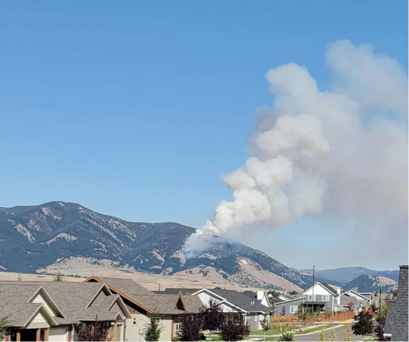
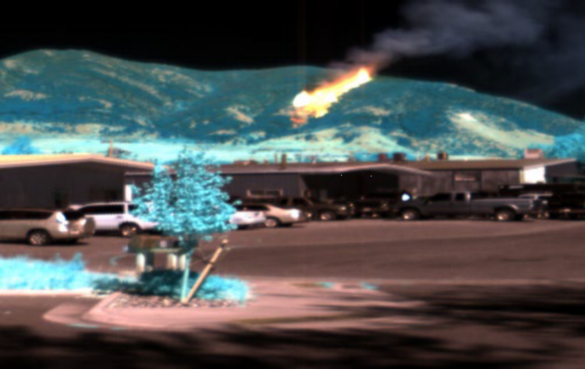 The false-color image was generated by three bands of the original DN data: 1499 nm, 1299 nm and 1103 nm.The integration time is set to 2.5ms, which is short enough to prevent sensor saturation in the fire area, and the spectral characteristics of the mountain fire are obvious,Eventually, the fire destroyed 28 homes on the eastern side of the mountain
HYPERSPECTRAL IMAGER MODELS SELECTION GUIDE:
Airborne Hyperspectral Remote Sensing System (ATHL9010)
https://www.optosky.net/ATHL9010.html
When the fire first started, workers observed it in the office and used a hyperspectral imager to take hyperspectral images of the fire.
HYPERSPECTRAL IMAGER MODELS SELECTION GUIDE:
Airborne Hyperspectral Remote Sensing System (ATHL9010)
https://www.optosky.net/ATHL9010.html
Using UAV-based hyperspectral imagery and LiDAR data to detect pine wilt disease
Estimation of corn yied base on hyperspectral imagery
Related Article

Discover Optosky’s air–ground collaborative hyperspectral solution for mine ecological restoration monitoring. Combining UAV hyperspectral imaging, fixed-point rotating-scan systems, and field spectroradiometers, it supports vegetation, soil, mineral alteration, and water environment monitoring for green mine evaluation and restoration acceptance.
Applications | Hyperspectral Mine Restoration Monitoring
Compare single InGaAs and CMOS+InGaAs detector architectures in hyperspectral imaging. Learn why both can cover 400–1700 nm, how visible-light-extended InGaAs works, and the trade-offs in calibration, spectral registration, and system integration for applications in agriculture, food safety, and industrial inspection.
Technology | Single InGaAs vs. CMOS+InGaAs in Hyperspectral Imaging
Discover how hyperspectral imaging combined with multi-feature fusion (PCA + 2DCOS + CARS) enables non-destructive three-level grading of chili pepper sunburn with 97.2% accuracy. Learn about the ATH3000 system and Optosky's customized solutions for horticultural crop quality inspection and damage classification.
Can Sunburned Chili Peppers Be Non-Destructively Graded? Hyperspectral Imaging ATH3000 Offers a New Answer
Discover the Optosky ATH9600 multi-lens UAV-borne multispectral imaging system—featuring 67° ultra-wide FOV, synchronous snapshot, 3.75 μm large pixel, and native DJI X-Port integration. Ideal for large-area farmland monitoring, orchard management, pest early warning, water quality inversion, and complex crop classification. Born for efficient, all-weather low-altitude remote sensing.
Born for Large-Area Remote Sensing! Optosky Releases the ATH9600 Multi-Lens UAV-Borne Multispectral Imaging System